Why a Fence Permit Needs a Site Plan At All
Building departments aren't worried about your fence falling over. They're worried about where it sits. A fence built six inches over a property line, across a utility easement, or blocking a sight-line at a corner lot can turn into a removal order months after the posts are already in the ground.
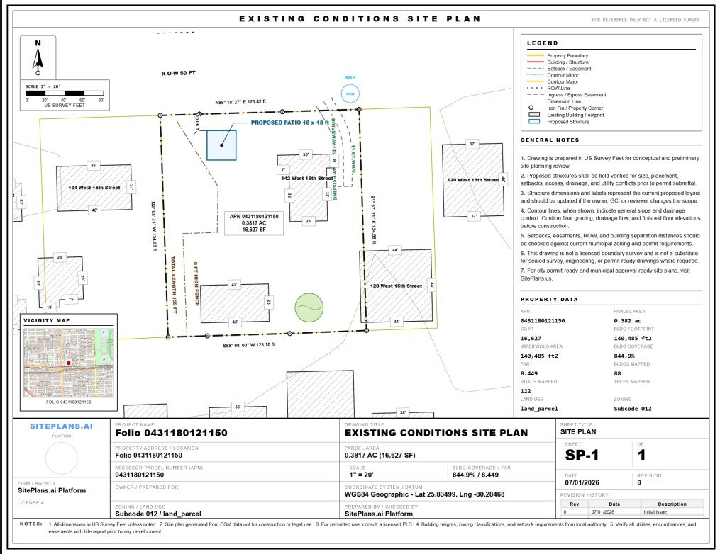
That's the entire reason the site plan exists: it's proof, on paper, that you checked before you built. It needs to show your property boundaries, the fence's exact path, its height and material, and how far it sits from every line and structure nearby.
Some cities will accept a simple homeowner-drawn plan for this. Others expect it drawn to scale off an actual survey. A few — like Marietta, Georgia — don't require a permit for fences at all, but zoning setbacks still apply whether or not a permit is pulled. You won't know which category your city falls into until you check, so that's step one, before you draw anything.
What Reviewers Actually Look For
| Element | Why It's There |
|---|---|
| Property lines with dimensions | Confirms the fence isn't encroaching |
| Fence path, start to finish | Shows exact run, not just intent |
| Height and material | Height limits are usually zone-specific |
| Gate locations and widths | Fire access and egress checks |
| Setbacks from lines and structures | Confirms zoning compliance |
| Easements crossed | Utility companies can require removal later |
Miss any one of these and the plan usually bounces — not rejected forever, just delayed while you fix and resubmit. That delay is the actual cost. It's rarely the fence itself that's the problem.
Where This Trips People Up
The property line is the part almost everyone gets wrong. Fence lines get built off old wooden stakes, a neighbor's word, or a rough guess from Google Maps satellite view — none of which hold up when a reviewer asks for dimensions.
Easements are the second trap. A utility easement running along your rear line doesn't show up on a casual walk of the yard, but it shows up the moment a utility company needs access and your new fence is in the way.
How SitePlans.ai Builds This For You
Instead of sketching from memory or hiring someone to draw a fence line for you, you start from the actual address:
- Enter your property address. How to Correctly
- Review the property lines and existing structures shown for your parcel.Select Parcel Guide
- Draw your proposed fence path directly on the lot. How to draw fence
- Label height, material, and gate locations.
- Add setbacks and flag any easements running near the fence line.
- Export a clean, title-block PDF ready to attach to your permit application.
This isn't a generic drawing app with boxes and arrows — it's built around actual site-plan structure, so the sheet looks like what a reviewer already expects to see, not something that needs to be redrawn.
Coverage note: parcel data quality varies by county. If your property lines look off once you pull up your address, cross-check against your county GIS or assessor records before you finalize anything.
Find your local building department in USA
When a Site Plan Alone Isn't Enough
If your fence sits in a floodplain, borders a historic district, or your city specifically requires a licensed survey for fence permits, a preliminary site plan won't clear that requirement by itself. In that case, either engage a licensed surveyor directly, or use SitePlans.us for a human-reviewed, permit-ready version built to your city's specific standard.
Who This Is Built For
- Homeowners installing a privacy fence, picket fence, or pool barrier
- Fence contractors pulling permits across multiple job addresses
- General contractors handling fencing as part of a larger scope
- Property managers replacing fencing on rental properties
Contractors running this across job after job should look at the Contractor Pro plan — more address lookups, more exports, and a branded title block instead of a generic one.
Disclaimer
SitePlans.ai helps create preliminary and permit-style site plans for smaller residential projects where local rules allow homeowner or contractor-prepared drawings. It is not a licensed land survey, engineering plan, architectural plan, or legal boundary document. Some jurisdictions require a licensed surveyor, engineer, architect, or other professional. Always confirm requirements with the local building department before submitting.
FAQ Items
Q: Do I need a site plan for a fence permit? A: Most cities require one. It needs to show your property lines, the fence's proposed location, height, material, and setbacks. Some cities exempt fences under a certain height from permits entirely, but zoning setbacks still apply regardless.
Q: Can I use SitePlans.ai for a fence permit application? A: Yes, in jurisdictions that accept homeowner or contractor-prepared site plans. It produces a preliminary, conceptual drawing — always confirm with your local building department that this format is accepted before submitting.
Q: What if my city requires a licensed survey for fences? A: Some do, especially near property disputes or in older platted subdivisions. SitePlans.ai isn't a substitute for that — you'd need a licensed surveyor's stamp in that case.
Q: What should actually be on the drawing? A: Property lines, existing structures, the fence path with height and material noted, gate locations, setbacks, easements, a north arrow, scale, and a title block with your name, address, and date.
Q: What if my property lines look wrong in the tool? A: Parcel data accuracy varies by county. Check against your local GIS or tax assessor's site, or use the done-for-you option from SitePlans.us for a checked version.
Q: Can contractors use this for multiple client jobs? A: Yes — Contractor Pro is built around exactly that: more lookups, more exports, and a company-branded title block.