# How to Create a Property Line Table
Corner lots and irregular parcels can end up with more property lines than a drawing can label cleanly. Instead of trying to fit every bearing and distance directly on the map, this tool converts them into a simple table.
Quick Answer
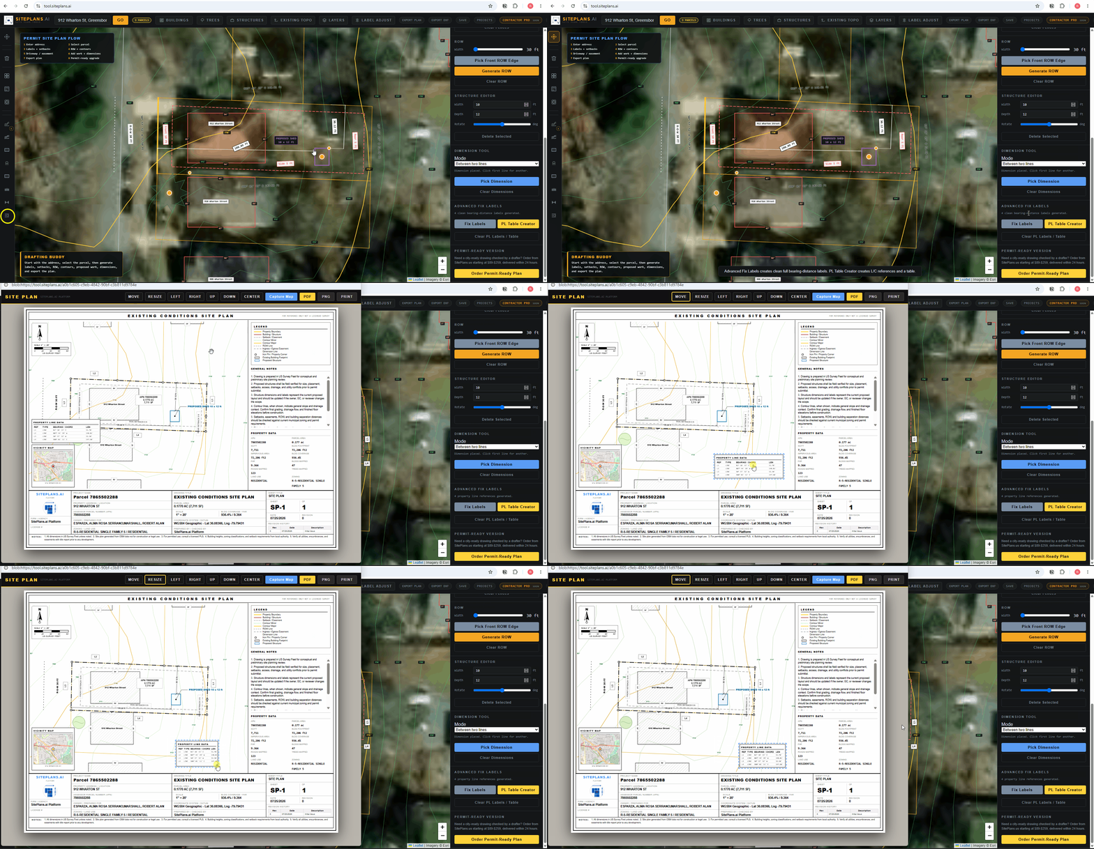
Go to Advanced Label Tools and select PL Table Creator — the yellow button. Every bearing and distance label turns into a simple reference (L1, L2, L3...) and a full table generates automatically in your title block sheet.
Step-by-Step
1. Open Advanced Label Tools from the right panel.
2. Click PL Table Creator. This is the yellow button.
3. Review the table. Every property line label converts to a short reference — L1, L2, and so on — with the full bearing and distance data moved into a table.
4. Go to your export screen. The table appears placed in your title block sheet.
5. Move it if needed. Use the Move tool to drag the table into the position that keeps your sheet looking clean, along with the vicinity map if you're adjusting that too.
When to Use This
Best for corner lots, irregular shapes, or any property with enough distinct property lines that individual labels would clutter the drawing. If your lot is simple — four sides, four labels — you probably don't need this.
Why This Matters for Permit Review
A cluttered site plan with overlapping labels is a common reason for rejection on readability alone. A clean reference table, the same way a licensed surveyor's plan handles a complex boundary, signals a more professional submission — and it's one of the features most free drawing tools don't offer at all.
Common Mistakes
Using this on a simple lot where individual labels would have been perfectly readable anyway — it's not necessary for every property.
Forgetting to reposition the table after it generates — the default placement isn't always the cleanest spot on your specific sheet layout.
FAQ
Does this replace the bearing and distance data?
No — it's still there, just organized into a table (L1, L2, etc.) instead of individual labels crowding the drawing.
Can I move the table after it's created?
Yes, use the Move tool from the export screen to reposition it anywhere on the sheet.
What's the difference between this and Fix Labels?
Fix Labels consolidates multiple labels along the same line. PL Table Creator reorganizes all your property lines into a table — better for genuinely complex, multi-sided lots.
Related Tools
- How to clean up property line labels
- How to build a title sheet that doesn't get rejected
- SitePlans.ai support center
Start Here
Create My Site Plan — Need help? Get support from SitePlans.us →