# How to Draw a Driveway
Driveways are drawn using the ingress-egress easement tool — built to trace the actual path from the street to your garage or parking area, at the real width.
Quick Answer
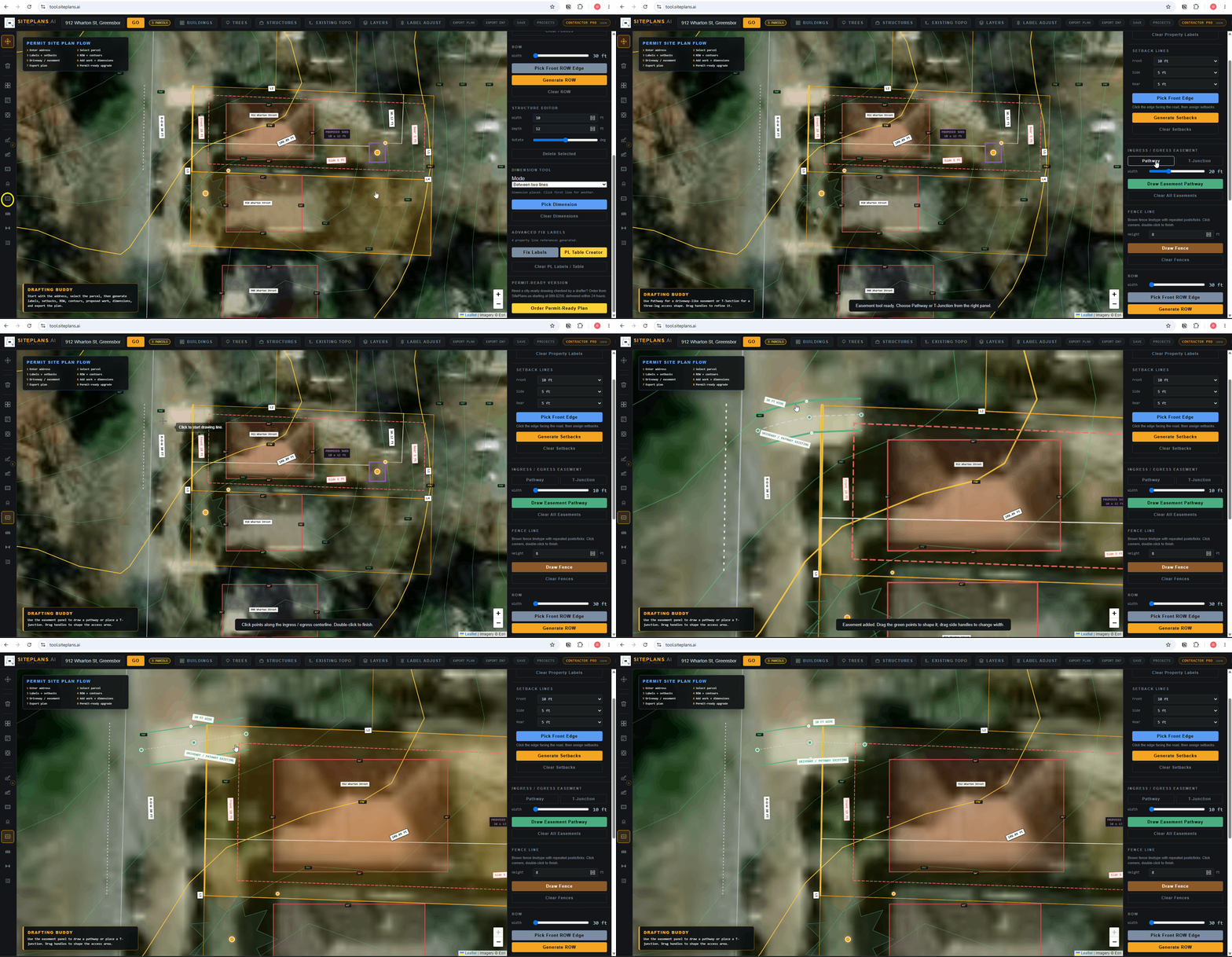
Select Ingress Egress Easement from the left toolbox. Enter your driveway width, then click to draw the path following the satellite image. Adjust the shape and size using the center points and edge handles once it's placed.
Step-by-Step
1. Select the tool from the left toolbox — Ingress Egress Easement.
2. Enter the width. Type your driveway's actual width — for example, 12 feet.
3. Draw the easement. Click along the satellite image to trace your driveway's real path from the street to your garage or parking area.
4. Zoom in and refine. Adjust the shape using the center points to reposition, and the smaller handle dots to resize sections.
5. Confirm it matches reality. Compare against the aerial image to make sure the traced path lines up with what's actually on the ground.
When to Use This
Any project where the driveway itself needs to appear on the site plan — new driveway permits, garage additions where access matters, or any project where a reviewer needs to see how the property connects to the street.
Common Mistakes
Guessing at the width instead of measuring the actual driveway — this affects how the drawing reads against your property's real dimensions.
Not comparing against the satellite image closely enough — a driveway that curves or narrows partway needs those details traced, not just a straight rectangle.
FAQ
Can I adjust the driveway shape after it's drawn?
Yes — use the center points to move sections and the edge handles to resize.
What if my driveway isn't a simple straight shape?
Trace it following the actual satellite image path, adding as many points as needed to match the real curve or angle.
Does this show the driveway connecting to the right-of-way?
Pair this with right-of-way generation if your city requires that shown alongside the driveway.
Related Tools
Start Here
Create My Site Plan — Need help? Get support from SitePlans.us →