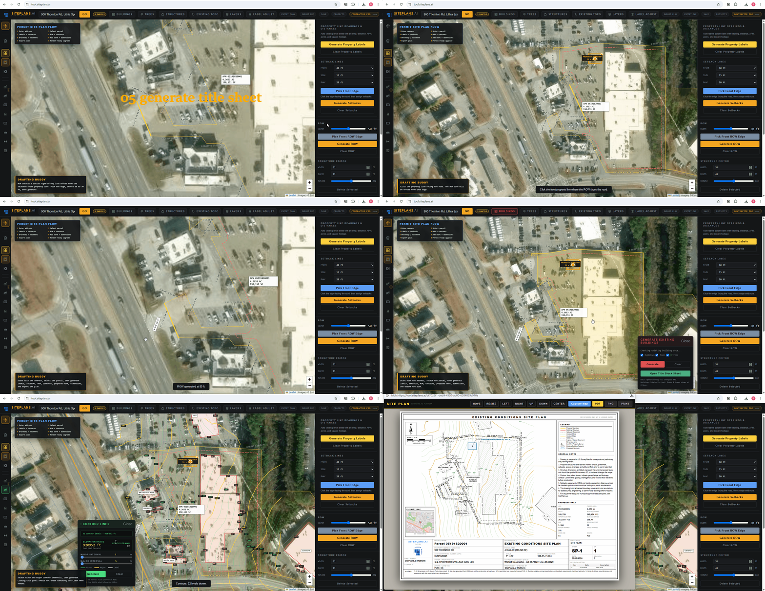
# How Your Title Sheet Is Generated in SitePlans.ai
By the time you've placed your first structure, most of your title sheet already exists. It's built from the same real parcel data that generates your property lines — not something you fill in from scratch.
Quick Answer
The moment you enter your address, your title sheet starts populating automatically: parcel identification number (APN), zoning code, land use, and date, with your property address typically printed directly on the house hatching. A vicinity map and property line table generate alongside it once you export.
What Generates Automatically
APN — your parcel identification number, pulled from county records.
Zoning code and land use — populated from the same parcel data.
Date — filled in automatically.
Property address — for most properties, this is printed directly on the hatches of the house itself, not just typed into a field.
Vicinity map — a small locator map showing your property's position relative to the surrounding area, generated alongside your main drawing.
Property line table — if you've used the PL Table Creator for a complex lot, that table places itself directly into the title sheet layout.
None of this requires manual entry. It's the same underlying parcel data driving your property lines that fills in the title sheet in parallel.
Where to Go From Here
Once the automatic fields are in place, the sheet title itself is yours to set — typically something like "Existing Site Condition Site Plan" for a base drawing, or "Proposed Full Permit Site Plan" once you've added your project. Company branding, project notes, and material specifications go in the notes section from there.
For the full walkthrough of customizing everything beyond what's automatic, see how to build a title sheet that doesn't get rejected.
Repositioning the Layout
Once you're on the export screen, the vicinity map and property line table are both movable — click Move and drag either element to wherever keeps your sheet looking clean, rather than accepting the default placement if it doesn't suit your specific drawing.
Why This Matters for Permit Review
A title sheet with real parcel data — not a blank template with typed-in guesses — is one of the things that separates a site plan built for permits from a generic drawing tool's output. A plan reviewer checking your APN or zoning code against county records is checking data that's already accurate, because it came from the same source they'd check against.
Common Mistakes
Assuming you need to manually enter the APN or zoning code — you don't; check that it's populated correctly rather than re-typing it.
Not repositioning the vicinity map or property line table when the default placement overlaps other elements on a busy sheet.
Leaving the sheet title as a generic default when it doesn't reflect what you're actually submitting — existing conditions versus a full proposed plan are different documents.
If Something Isn't Working
Fields aren't populating — confirm your address was entered and your parcel is actually selected; automatic title sheet data depends on that step being complete first.
Address isn't printing on the house hatching — this happens automatically for most properties; if it's missing, check that your address search returned a clean parcel match.
Vicinity map looks wrong or is missing — generates based on available data for your area; coverage quality can vary by location.
When to Get Help
Reach out to SitePlans.ai support or use SitePlans.us if your automatic parcel data looks incorrect, or you want a professional to verify your title sheet before submission.
Related Tools
- How to build a title sheet that doesn't get rejected
- How to create a property line table
- How to export your site plan PDF
- SitePlans.ai support center
FAQ
Do I need to manually fill in my APN?
No — it's pulled automatically from parcel data the moment your address is entered and your parcel is selected.
Will my property address show up automatically?
For most properties, yes — typically printed directly on the house hatching rather than requiring manual entry.
What's the vicinity map, and where does it come from?
A small locator map showing your property's position relative to the surrounding area, generated automatically alongside your main drawing.
Can I move the vicinity map or property line table?
Yes — use the Move tool from the export screen to reposition either element anywhere on the sheet.
What's the difference between this and editing the title sheet?
This covers what generates automatically. Editing the title sheet covers customizing the sheet title, adding notes, and branding once the automatic fields are already in place.
Does the title sheet update if I change my project?
Yes — the sheet title and content should reflect your current project; update the sheet title manually if you've moved from an existing-conditions drawing to a full proposed plan.
What if the automatic data looks wrong?
Cross-check against your county's parcel records. If there's a real discrepancy, contact support or use SitePlans.us for a human-reviewed plan.
Start Here
Create My Site Plan — Need help? Get support from help desk →